An alternative Cityguiding through Istanbul
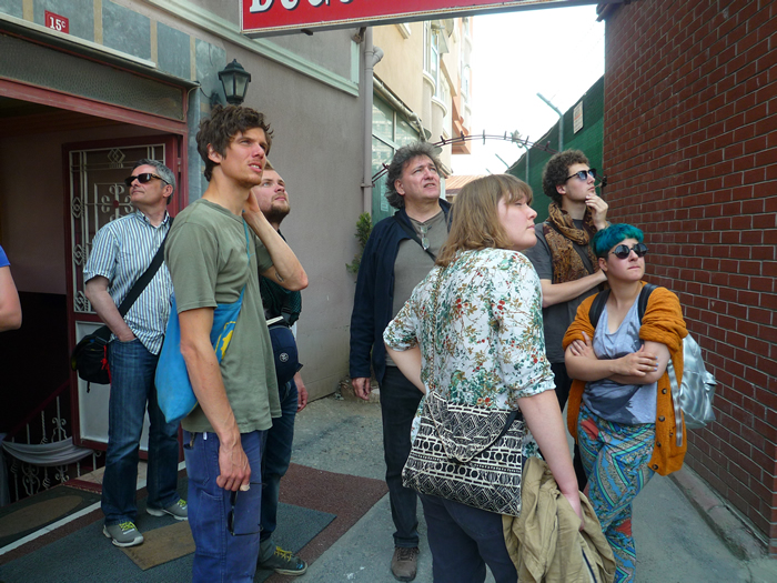
The map of Istanbul for tourists, which includes the Sultanahmed-Region and Beyoğlu, covers only about one or two percent of the real Istanbul map. In order go beyond these two percent join an „alternative citiyguiding“ (or an architectural field trip as he calls it) with Orhan Esen.
Istanbul and the Mahalle-System in the 19th Century
In a Mahalle (typical neighbourhood from the 16th or 17th century) the streets don’t have any geometry, they look like a labyrinth. In the absence of capitalism there is no private property, the state gives land to mosque foundations and from them people can get their plots or rather the using rights. This land is no private property, so nobody would sell, rent or speculate with land. In contrast to todays’ system there is a collective responsability:
In a Mahalle all social classes are living together and the system of redistribution ensures sharing, for example larger gardens are open for everyone.
This Mahalle-system prevents capital-accumulation and works like a social state. In the 16th and 17th century the system worked very well, but in the 18th century it did not. So major changes took place in the 19th century:
With the British Trade Agreement in 1838 the Ottoman economy was introduced to the capitalist Western world. Now plots are private property and there is a clear differentiation between private and public spaces. Some plots become more valuable than others.
In Cihangir you have a better view, but also more winds, so you need more money for heating. In a valley there is less view but also less winds. That’s why richer people settled in places with good views and poorer people in the valleys.
After 1838 a new social map emerged:
Grapic by Orhan Esen
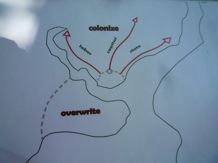
The state „moved“ when the Sultan decided to move from Topkapi Palace to the Dolmabahçe Palace on the other European side. Also the money „escaped“ the Sultan-Ahmed-region and „went“ up north towards Taksim. The labor „settled“ in the Golden-Horn-Area as sea trade between the Black Sea and the Mediterranean Sea became more and more important.
When population grew it was very common (along with the colonization of new land) to „overwrite“ whole quarters. That means to tear down all old buildings and built up new ones with more space as well as using bricks which cannot burn as easily as wood.
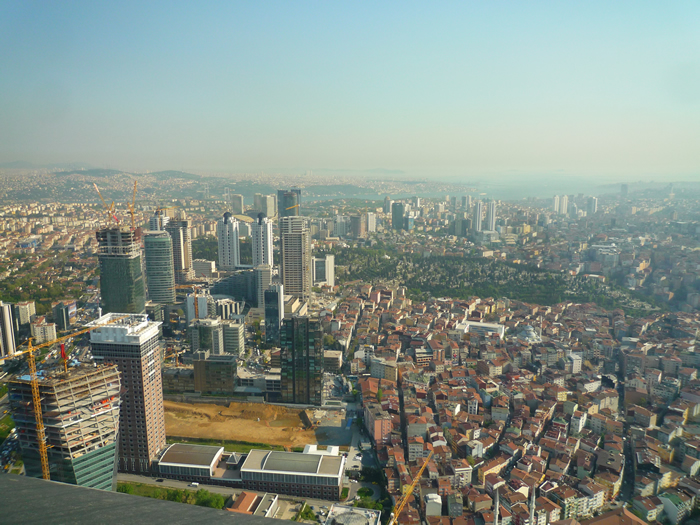
Levent – The real citycenter of Istanbul


According to Orhan, the quarter of Levent is the real citycenter of Istanbul. In Istanbul there was a need for a place with big office buildings and as around 1950 many factories were shut down in Levent, the city council decided to built up the new „office town“ there. Levent, with its high and modern buildings, became a real business district.
Shoppingmalls – the new socializing spot
In Levent you can find lots of shopping malls. Within one km there are three different ones. In these malls people do not go only for shopping, it is also a new kind of socializing space to meet friends, chat, eat and hang out.


There is a shopping mall for every budget. In the Kanyon-Mall, for example, you can find very exclusive shops and the price level is really high. But there are also malls for small budgets. What happens is, that according to their status and money, people socialize in different shopping-malls and obviously some people are excluded.
The people who lived in the quarter next to Levent, Kağithane, used to come to Levent to work in the factories there. Now that there are no factories anymore, they work in the malls and offices as security personal or cleaners.
Kağithane – the Gecekondu next to Levent

This quarter next to Levent is a gecekondu. The term gecekondu derives from the Turkish words “gece”, meaning “night” and “kondu” – meaning “placed” or “landed” and can thus be translated as “placed overnight”.
Gecekondus usually develop within walking distance to industrial sites where its inhabitants go to work, like the factories that used to be in Levent.
It is important to know that gecekondus are not just housing for the ultra-poor, as it might be the case in shantytowns in other countries. According to estimates in 2002 over 50 percent of Istanbul residents lived in a gecekondu at that time.
Gecekondus are also called „Garden-cities“ because there is a lot of green space and the people also own small animals, like chickens. So the people who come to the city and live in gecekondus are neighter farmer, as they used to be, nor yet worker.
The legalisation of gecekondu neighbourhoods often led to former squatters becoming real estate entrepreneurs, demolishing small garden houses and building multiple-storey apartment blocks in their place.
Now the gecekondu Kağithane is no longer a „Buffer-zone“ for new arrivals. After the legalization the quarter has already developed as well as its inhabitants. Orhan thinks that sooner or later there will arise the need for an „upgrade“ and urban transformation will take place here.
The question is: What will be the basic management model for this? In his opinion the „overwritting“ of this quarter with „Star-buildings“ is no solution.


Read also The Physiology of Public Space by Alexandru Balasescu